Mud begins at the knee – welcome to the West Coast Trail!
Intro to the West Coast Trail
Preparation for the West Coast Trail
Day 2 The Rain Cover (Cribs Creek to Walbran Bay)
Day 3 The Step counter (Walbran Bay to Campers Bay)
Day 4 The Necessaire (Campers Bay to Trasher’s Cove)
Day 5 Fed-up
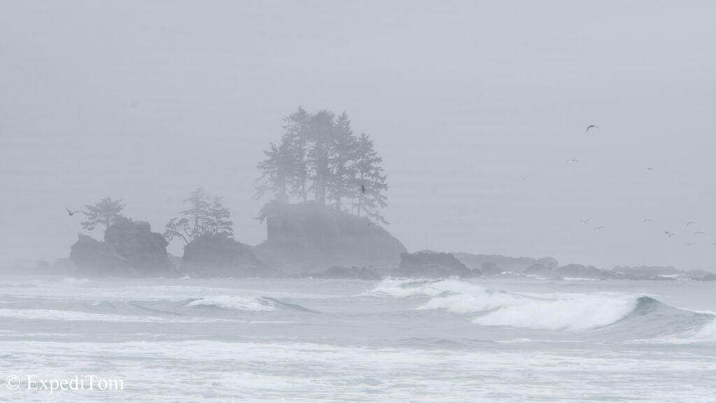
The West Coast Trail was originally built to rescue sailors from frequent shipwrecks. At first, I wondered why there were so many wrecks along this coast, but eventually found out about the inclement weather, the dense fog and unsure forecasts of this treacherous section of coastline.
It’s been a while, but the memories are still vivid. In August 2018, Philippe and ExpediTom undertook another epic adventure together. This time trekking the WCT. This trail leads 75km through the Pacific Rim National Park and offers many highlights along the way. Even though many people venture on this trail, there is still plenty of space to feel solitude. The occasional meetings with other like-minded hikers rather adds to the experience. But more on that later.
Yet, I advise you to not take it too light-heartedly because according to Parks Canada, in average 1% of all hikers must be rescued. This is mainly due to the surge channels, hikers being surprised by tides, and slippery roots.
Phil and I prepared for the WCT in Vancouver and drove by ferry to Vancouver Island and by bus to Victoria.
Arrival at the starting point in Nitinaht
The following morning, we left all unnecessary belongings at the hostel and hiked to the pick-up location. No tablet, no drone, no deo, no fishing rod, no underwear – just kidding.
I wore one.
While we were waiting for the bus, we enjoyed an apple crumble from the nearby bakery. The last delicacy for the following days. I thought. We had learnt our lesson how important food quality can be on the Huemul trek and we packed an additional pack of sweets.
It was not only us waiting for the bus. There was another family with 2 kids and 2 more couples awaiting transportation. I talked to some of them, but it appeared we were the only once who started at the middle point in Nitinaht.
Nitinaht
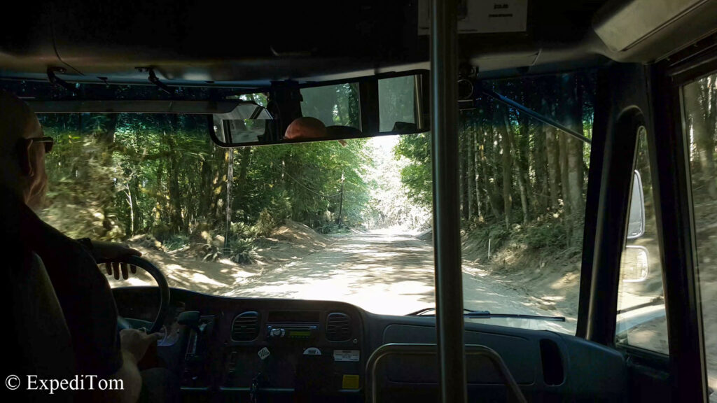
After about 5 hours and a short break at a store, we arrived at a junction in the middle of nowhere. This was the entrance to the Ditidaht and Pacheedaht First Nations reserve. There we were picked up by a car, because they do only allow local transports to work on their land. We drove along a wonderful river and I missed my fly rod. However, the Indigenous guy told me that it is not allowed to fish there, although there were thousands of salmon running up in a few weeks.
We were dropped off at the community center, which was as well the supermarket, and the only restaurant, but actually – a gasoline station.

We were asked to be back at the gasoline station at a specific time. Meanwhile, we walked down to the waterfront camping and set up camp. Although the drive took us quite some distance from any major town, we soon realized this place was famous for its constant winds. There were more than 50 kite- and windsurfers on the water. It was amazing to observe.

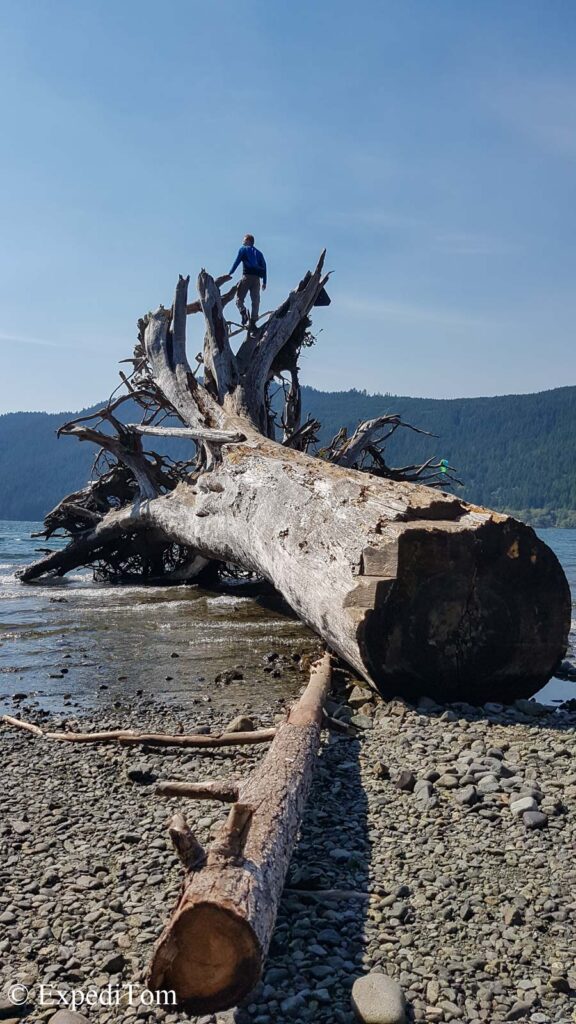
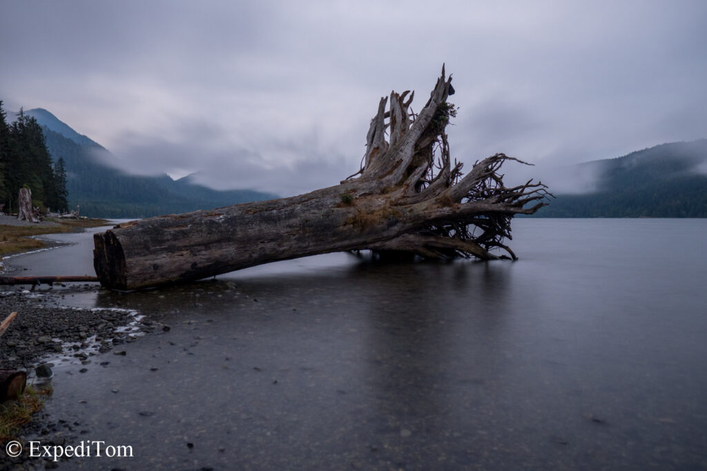
What really caught my eye, was something else: The vegetation was drastically different than anything I was accustomed to. The trees were massive and standing as tall as assumably 30 or 40 meters. The most impressive of all, was the one that was lying on the beach. This drift wood looks as if from another planet. It was huge.
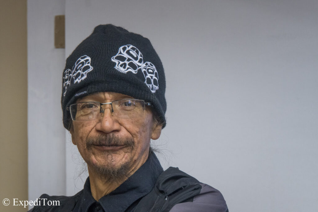
Indigenous People
Perry the cook who I met and talked to in the gasoline station, told me that it was a really big storm that brought in this tree. The First Nation people named the tree, but I forgot to take notes. Phil, I, and about 12 other people who started from the middle point met again in the community center. However, the informant from Parks Canada did not show up. We were told to come the following morning.
Given that our ferry to the trail left the following day at 9am, the hikers were worried to miss it. Perry assured me they will wait for us.
Back at the camp, we cooked dinner, watched the surfers jump and prepared to hit the pillow (neither of us had a pillow). Yet, there were no bear proof containers in this camp. Most of the surfers had their own vehicle and stored supplies within. So, I talked to our neighbors who were glad to help us out with a box that can be weighed with stones. Although this is not really bear proof, it allowed us a) to not have any food in our tent and b) prevented the crows, rats and racoons to steal.
I was excited to be finally back in some true wilderness and the light drizzle on the tent did not bother me at all.
Day 1 The Map (Nitinaht to Cribs Creek)
Information
The following morning, we were back at the gasoline station and received the mandatory introduction. We were informed about the dangers on the trail, which is not only animals such as wolfs, cougars and bears, but also surge channels, slippery roots and Tsunamis. Moreover, we got a map and a tide table, which I decided to take a picture of in case it gets wet. We paid the ferry and off we went.

Back and forth all night on the …
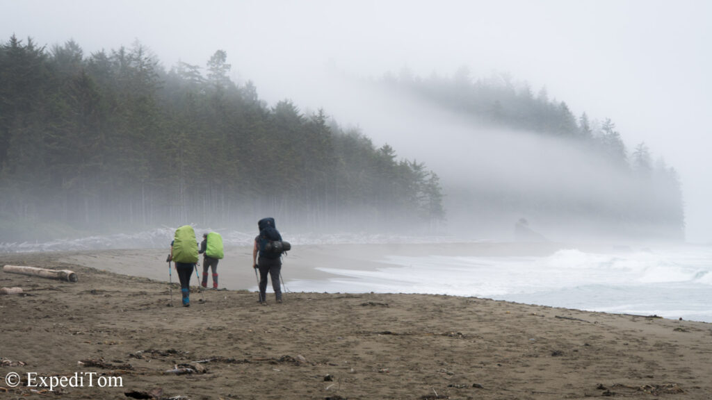
During the ferry ride over Lake Nitinaht, I got to know “the group of 7”, who also were southbound. This name was given to them by the Parks Canada guy. The group was mixed in age and gender and to this day, I don’t know their relation to one another. However, we met them on a regular basis throughout the hike until a certain point. More on that later.
Let’s get it on
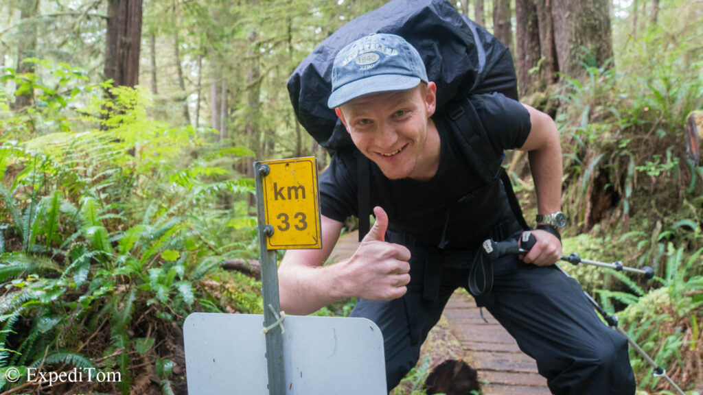
Arriving at a small swimming fishing village at the mouth to the sea, we were dropped off. The sign read that we started at kilometer 33 from 75. The very first impression was that it lives up to its reputation as a rainforest. The humidity was intense and the foliage as dense as it gets. Having walked only a few minutes, it felt as if we were miles away from anything. I was glad that the trail was well-maintained with wooden planks. Some of them looked pretty rotten and it appeared to me like a game at what point the wooden plank will break.

Where’s …?
We heard the crashing of the waves for some time. Eventually, we reached a point where the dense foliage opened and allowed us to view the sea. It was majestic.
Eating some snacks, I asked Phil for having a look at the map. Yet, we could not find it anymore. Lucky us we had made copies. Neither of us knew, where or how we had lost it. Probably it was still lying in the gasoline station.
Nevermind.

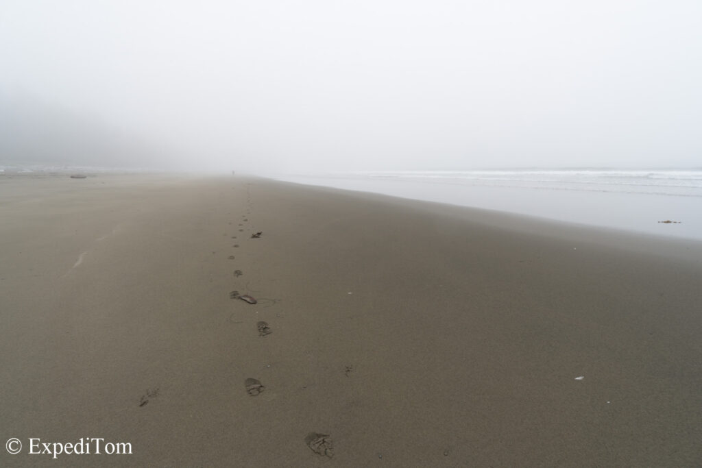
Continuing the hike, we decided to hike as much as possible on the beach. Therefore, we chose the next beach access and followed the beach all the way to Cribs Creek. The scenery along the beach was mysterious. There was thick fog which kept visibility low, but we heard waves crashing. The serenity was only disrupted by the arduous task of walking on sand. Hiking poles would have been useful at this point. On the way, we ran into the group of seven as well as another couple who had started the trail in Nitinaht.
Cribs Creek
At Cribs creek, there were many hikers who came from the South. I felt a slight unease because it was not the backcountry experience, I was looking for. (Note: you can camp almost anywhere along the trail and the signed camping spots are just recommendations. They provide some basic necessities such as composting toilets and bear proof boxes though). Nonetheless, we set up camp at Cribs creek in the woods, which was decorated with many colorful buoys. Furthermore, we set up the tarp which allowed us to leave the backpacks in front of the tent rather than block the entrance to the tent. This was great. The composting toilet had a sign which fittingly read: poo with a view.


We ate dinner at the beach, locked our food in the containers, and went to bed by 7pm.

Do you have any question? What would you like to know?
Here’s a blog post about preperation for the WCT
Read more!
Preparation for the West Coast Trail
Day 2 The Rain Cover (Cribs Creek to Walbran Bay)
Day 3 The Step counter (Walbran Bay to Campers Bay)
Day 4 The Necessaire (Campers Bay to Trasher’s Cove)
Day 5 Fed-up
Discover more from ExpediTom
Subscribe to get the latest posts sent to your email.


7 Responses